
You are here: Home » Coastal Breaks » Weymouth
Weymouth
| Destination: Weymouth | Operator: Grindles Coaches Ltd Terms |
| Departs: 12/08/2026 | Type: Coastal Breaks |
| Duration: 1 day | Quality: Good * * * |
| Departs Via: South West | Transport: Coach Pickup |
| Tour Code: S3820087 |
OAPs £27.00
Adults £27.00
Children £27.00
Deposit Per Person Payment required in full
* Children: Max age 16
* Babies: Not allowed
Adults £27.00
Children £27.00
Deposit Per Person Payment required in full
* Children: Max age 16
* Babies: Not allowed
16 seats are available.
Cutoff Date: 29/07/2026 00:00
Description
A day excursion to Weymouth offers a perfect mix of seaside charm and vibrant history. Visitors can enjoy the sandy beaches and clear waters of Weymouth Bay, ideal for relaxing or a leisurely stroll along the promenade. Explore the town’s picturesque harbor, where you can watch boats sail by or visit the historic Nothe Fort for stunning views of the coastline. With quaint shops, cafes, and attractions like the Sea Life Centre, Weymouth promises a fun and refreshing day out for all ages.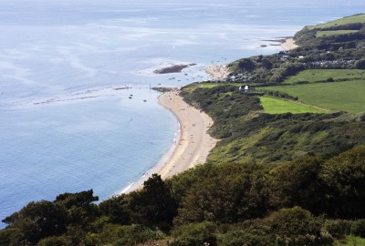
Pick-Up Points

Click the compass icons to preview pickups.

↑ Return to Top - Contact Us - F.A.Q. - Coach Operators - Group Bookings - Hotels - Attractions - Sitemap - Home
© CoachBookings.com 2026 - Company no. 5808080 - Privacy Policy - GDPR Compliance - Terms & Conditions
CoachBookings.com, 17 Birley Street, Blackpool, FY1 1EG, United Kingdom. 0345 33 11 080
CoachBookings.com, 17 Birley Street, Blackpool, FY1 1EG, United Kingdom. 0345 33 11 080