
Bookings for this holiday are now closed
You are here: Home » Events, Shows, Specials » Warner Leisure Hotels - Littlecote House
Warner Leisure Hotels - Littlecote House
| Destination: Berkshire | Operator: Crusader Holidays Terms |
| Departs: 10/10/2011 | Type: Events, Shows, Specials |
| Duration: 5 days | Quality: Excellent * * * * |
| Departs Via: South East | Board: Half Board |
| Tour Code: D12600 | Transport: Coach Pickup |
Adults £349.00
Deposit Per Person Payment required in full
* Children: Not allowed
* Babies: Not allowed
Sorry! This trip has sold out.
Deposit Per Person Payment required in full
* Children: Not allowed
* Babies: Not allowed
Sorry! This trip has sold out.
Description
Warner Leisure Hotels are renowned for their beautiful buildings and relaxing surroundings. Each of the hotels offers a variety of experiences for you to try or simply relax and enjoy the Warners’ holiday experience!Itinerary
Included excursion - OxfordThe City of Dreaming Spires, famous the world over for its University and place in history.
Venue Information
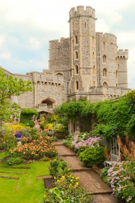
Littlecote HouseThis stunning 16th century mansion is steeped in history with its famous Orpheus Mosaic and remains of the Roman villa and an awe-inspiring Great Hall, Dutch Parlour, Cromwellian chapel and spiral Jerusalem stairs leading to the troops’ quarters and Long Gallery.
Pick-Up Points

Click the compass icons to preview pickups.

↑ Return to Top - Contact Us - F.A.Q. - Coach Operators - Group Bookings - Hotels - Attractions - Sitemap - Home
© CoachBookings.com 2026 - Company no. 5808080 - Privacy Policy - GDPR Compliance - Terms & Conditions
CoachBookings.com, 17 Birley Street, Blackpool, FY1 1EG, United Kingdom. 0345 33 11 080
CoachBookings.com, 17 Birley Street, Blackpool, FY1 1EG, United Kingdom. 0345 33 11 080