0345 33 11 080
CoachBookings Logo
Bookings for this holiday are now closed
You are here: Home » Short Breaks » Dover Castle & Wartime Tunnels

Dover Castle & Wartime Tunnels

Destination: KentOperator: Crusader Holidays Terms
Departs: 10/03/2012Type: Short Breaks
Duration: 2 daysQuality: Good * * *
Departs Via: South EastBoard: Half Board
Tour Code: M16637Transport: Coach Pickup
Supplements
Single Room £25.00 per person
Adults £99.00
Deposit Per Person Payment required in full
* Children: Not allowed
* Babies: Not allowed
Sorry, there's not enough time left to book you on this trip!
Description
Immerse yourself in centuries of military, medieval and royal history with a splendid day out at the ‘Key to England’.

HIGHLIGHTS
• Hotel for one night with breakfast and dinner
• Welcome drink and tea/coffee served after dinner
• Included excursion into Dover Castle & Wartime Tunnels
• Included visit to Canterbury
Itinerary
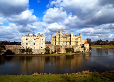
DAY 1 Departure then Dover Castle & Wartime Tunnels: After a morning departure we visit the magnificent Dover Castle situated proudly above the White Cliffs of Dover in Kent. Founded in the 12th century, often described as the ‘Key to England’ the castle is the oldest fort in England. Due to its prime location overlooking the English Channel and facing Western Europe, Dover Castle has experienced intensive defensive significance throughout history and has guarded our shores from invasion for 20 centuries. Originally strengthened from an Anglo-Saxon fort in 1066 by William the Conqueror further additions were made by Henry II and Henry VIII. In more recent history the castles defenses were successively updated in response to every European war involving Britain, most famously with the use of the secret tunnels in WW2. These secret tunnels date back as far as 1803 when during the Napoleonic Wars the tunnels housed more than 2,000 men. The outbreak of WW2 in 1939 saw the tunnels converted to a military command centre and underground hospital. It was from the secret tunnels below Dover Castle that Admiral Sir Bertram Ramsey directed the evacuation of French and British soldiers from Dunkirk, code-named Operation Dynamo. The castle and tunnels encapsulate a long and immensely eventful military and royalty history. A visit is sure to be memorable and should not be missed.

LAST DAY Travel home: We depart for home, en route visiting Canterbury before arriving home during the evening.
Venue Information
3* minimum Dover Hotel

Your hotel will be allocated nearer to departure, but will be of a minimum 3* standard within easy reach of the Dover area. All bedrooms will be en suite with TV.
Picture: Click to ViewPicture: Click to ViewPicture: Click to View
Pick-Up Points
.Ashford The Prince Albert Roundabout Map
.Attleborough Outside HSBC Bank Map
.Barking Longbridge Road Bus Stop Map
.Basildon Coach Stop Outside Trafford House Map
.Beckenham Bus Stop Opposite Wimpy Map
.Beddington Broadway Bus Stop Opposit Plough Public House Map
.Bexhill Town Hall Map
.Bexleyheath Central Library Map
.Billericay Bus Stop Map
.Birchanger M11 Services Coach Park Map
.Bletchley Bus Station Map
.Blythburgh A12 White Hart Public House Map
.Brentwood Outside Holiday Inn Map
.Brighton St Peters Church Bus Stop Map
.Bromley Bromley North Railway Station Map
.Buckhurst Hill Outside Premier Inn Map
.Bury St Edmunds Bus Stop Outside Tesco Map
.Cambridge Bus Stop Outside Railway Station Map
.Canterbury Outside Canterbury East Railway Station Map
.Carshalton Bus Stop Near Post Office Map
.Chalkwell Park Bus Stop Map
.Chatham Go Outdoors Bus Stop, Adjacent To Gala Bingo Map
.Cheam Bus Stop A Map
.Chelmsford Coach Bay Map
.Cheshunt Turners Hill (B176) Map
.Clacton On Sea Crusader Business Park Map
.Clacton-on-Sea Outside Railway Station Map
.Colchester Outside Gala Bingo Map
.Crawley Bus Station, Stand E Map
.Crawley Stand E, Bus Station Map
.Crayford Opposite Town Hall Map
.Crowborough Jades Palace Restaurant Map
.Dagenham Outside Morrisons Map
.Dartford Civic Centre Bus Stops Map
.Dover Dover Passenger Terminal Map
.Dunstable Bus Stop Layby Map
.Eastbourne Outside Pier Entrance Map
.Eltham Rail Station Bus Terminus Map
.Enfield Town Southbury Road Bus Stop Map
.Ewell Bus Stop Opposite Bourne Hall Map
.Faversham Bus Stop Outside Sports Gnd Map
.Folkestone Bus Stop Outside BP Garage Map
.Frinton On Sea Bus Stop Adjacent To Railway Station Map
.Gants Hill Outside Network Q Map
.Gillingham Bus Stop Map
.Gorleston The Library Map
.Gravesend Layby Outside Sainsburys Map
.Grays The Oak Public House Map
.Great Yarmouth Vauxhall Railway Station Map
.Hadleigh Bus Stop Opposite Fire Station Map
.Harlow Bus Station, Near Taxi Rank Map
.Hastings Summerfield Sports Centre Map
.Hatfield Galleria Centre Main Entrance Bus Stop Map
.Hemel Hempstead Outside Bus Station Map
.Holland On Sea The Roaring Donkey Map
.Hornchurch North Street Queens Theatre Bus Stop Map
.Hove Bus Stop Outside Town Hall Map
.Ipswich Railway Station Map
.Kelvedon Railway Tavern Bus Stop Map
.Kessingland Post Office Map
.Kings Langley Outside GPO Sorting Office Map
.Kingston Bus Stop B4 Map
.Kirby Cross Bus Stop Opposite Railway Station Map
.Leigh On Sea Outside The Elms Public House Map
.Leighton Buzzard Bus Stop Outside Halifax Map
.Loughton Trapps Hill Bus Stop Map
.Lowestoft Bus Stop Outside Railway Station Map
.Luton Travel Lodge Map
.Maidstone Bus Stop Map
.Marks Tey Bus Stop Outside Fish & Chip Shop Map
.Mildenhall Barton Mills A11 Little Chef Travel Lodge Map
.New Eltham Bus Stop Opp Railway Station Map
.Newmarket Bus Stop Palmers Map
.Norwich Bus Layby John Lewis Map
.Pakefield Tramway Hotel Map
.Pease Pottage M23 Services Map
.Polegate Bus Stop Outside St George Church Map
.Ponders End Tescos Map
.Potters Bar Bus Stop Junction Of Southgate Road Map
.Rainham Outside Cricketers PH Map
.Rayleigh Outside Railway Station Map
.Redbridge Outside Tube Station Map
.Reigate Bus Stop Map
.Rochester Bus Lay By Near Dickens Centre Map
.Romford St Edwards Way Map
.Sevenoaks Bus Terminus, Entrance Off High Street Map
.Shoeburyness Bus Stop Inside Asda Map
.Sidcup Bus Stop Near Police Station Map
.Sittingbourne Railway Station Map
.South Benfleet New Bus Stop Map
.South Mimms M25/A1M Services Coach Park Map
.Southchurch Outside White Horse Map
.Southend Victoria Circus Bus Stop Map
.St Albans Bus Stop Outside DM Jewellers Map
.Strood Bus Stop Map
.Sutton Bus Stop L Opposite Police Station Map
.Thetford Minstergate Bus Station Map
.Thorpe Bay Railway Station Map
.Thurrock Moto Services Coach Park Map
.Tolworth Bus Stop F, Outside Marks & Map
.Tonbridge Bus Layby Map
.Tunbridge Wells Bus Stop B Near Railway Station Map
.Upminster Bus Stop A Opp. Railway Station Map
.Waltham Cross Hertford Road Bus Stop Map
.Walthamstow Bus Stop Opposite Hospital Map
.Watford Watford Railway Station Map
.Westcliff Palace Theatre Map
.Wickford Halls Corner Map
.Witham Lloyds The Chemist Map
.Woodford Green Bus Stop Opposite Castle Public House Map
.Worthing Outside Central Railway Station Map
.Wrentham A12 Village Bus Stop Map
Click the compass icons to preview pickups.
↑ Return to Top - Contact Us - F.A.Q. - Coach Operators - Group Bookings - Hotels - Attractions - Sitemap - Home