0345 33 11 080
CoachBookings Logo
Bookings for this holiday are now closed
You are here: Home » Sight Seeing » Rhone Alps
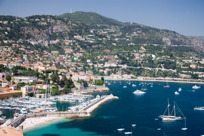
Rhone Alps

Destination: FranceOperator: Crusader Holidays Terms
Departs: 13/06/2010Type: Sight Seeing
Duration: 7 daysQuality: Good * * *
Departs Via: South EastBoard: Half Board
Tour Code: J6645Transport: Coach Pickup
Supplements
Single Room £120.00 per person
Adults £475.00
Deposit Per Person Payment required in full
* Children: Not allowed
* Babies: Not allowed
Sorry! This trip has sold out.
Description
Here’s your chance to visit one of the French Alps’ most cherished and highly –acclaimed resorts.
Itinerary
Day 1 Departure
A morning departure to Dover and our ferry crossing to Calais. We continue through France to our overnight hotel.

Day 2 Travel to La Clusaz via Beaune
We visit Beaune for a lunch stop and in the afternoon we have our first sight of the mountains before arriving in La Clusaz for our 4 night stay.

Days 3-5 At leisure
At leisure in La Clusaz with two included and one optional excursion.

Included Excursion
Full Day Savoy Alps & Chamonix An excursion to the Savoy Alps. We visit Chamonix, at the foot of Mont Blanc. You may take an optional Cog Railway ride or Cable Car Ride.

Included Excursion
New Full Day Lake Geneva A full day included excursion to Lake Geneva, visiting the Swiss resorts of Montreux and Vevey. From here you can take an optional boat trip across the lake to the French lakeside resort of Evian where we rejoin our coach to return via Geneva back to the hotel.

Optional Excursion
New Half Day Annecy A half day optional excursion to Annecy, the “Venice of Savoy”, a beautiful town criss-crossed by small streams and canals. There are plenty of opportunities here for ambling through the narrow streets and for retail therapy. The road into the town runs by the side of the lake, which is clean, fresh and of a wonderful azure colour.

Day 6 Travel to overnight hotel
We retrace our steps northwards to our overnight hotel.

Last Day Travel home
We depart for Calais and our ferry crossing to Dover, arriving home during the evening.
Venue Information
Best Western Alpen Roc, La Clusaz
We stay for 4 nights at the Best Western Alpen Roc hotel located in the centre of La Clusaz, facilities here include a restaurant, bar, lounge, indoor pool & sauna. All bedrooms are en suite. Please note that on some departures you may be accommodated at the nearby Hotel Beauregard, both hotels have similar facilities and en suite bedrooms.
Picture: Click to ViewPicture: Click to ViewPicture: Click to ViewPicture: Click to View
Pick-Up Points
.Ashford OBrians Public House Map
.Attleborough Outside HSBC Bank Map
.Baldock Xtra Services Map
.Barking Longbridge Road Bus Stop Map
.Basildon Coach Stop Outside Trafford House Map
.Basingstoke Bus Stop B Outsidethe Malls Shopping Centre Map
.Beckenham Bus Stop Opposite Wimpy Map
.Beddington Broadway Bus Stop Opposit Plough Public House Map
.Bexhill On Sea Town Hall Square Bus Layby Map
.Bexleyheath Central Library Map
.Biggleswade Bus Station Map
.Billericay Bus Stop Map
.Birchanger M11 Services Coach Park Map
.Bishops Stortford Station Approach Map
.Bitterne Bullar Gyratory Bus Stop Map
.Blythburgh A12 White Hart Public House Map
.Bournemouth Yellow Buses Bus Stand 6 Map
.Braintee Bus Stop Outside Tesco Map
.Brentwood Bus Stop Near KFC Map
.Brighton St Peters Church Bus Stop Map
.Bromley Bromley North Railway Station Map
.Buckhurst Hill Outside Premier Inn Map
.Bury St Edmunds Bus Stop Outside Tesco Map
.Cambridge Bus Stop Outside Railway Station Map
.Canterbury Outside Canterbury East Railway Station Map
.Carshalton Bus Stop Near Post Office Map
.Chatham Outside Holiday Inn Map
.Cheam Bus Stop A Map
.Chelmsford Army & Navy Layby Map
.Chelmsford Coach Bay Map
.Cheshunt Turners Hill (B176) Map
.Christchurch Bus Stop Opposite Sommerfields Map
.Clacton On Sea Crusader Business Park Map
.Clacton-on-Sea Outside Railway Station Map
.Colchester Outside Gala Bingo Map
.Crawley Bus Station, Stand E Map
.Crayford Opposite Town Hall Map
.Crays Hill Shepard & Dog Public House Map
.Crowborough Jades Palace Restaurant Map
.Croyden Nestle Tower Bus Stop KC Park Park Lane Map
.Dagenham Outside Morrisons Map
.Dartford Civic Centre Bus Stops Map
.Dickleburgh Chenery Garage Map
.Diss Bus Station Map
.Dover Dover Passenger Terminal Map
.Dovercourt Bus Stop Map
.Dovercourt Railway Station Map
.Dovercourt The Devon Public House Map
.Duxford Bus Stop Imperial War Museum Map
.Eastbourne Outside Pier Entrance Map
.Eltham Rail Station Bus Terminus Map
.Enfield Town Southbury Road Bus Stop Map
.Enfield Outside U G C Cinema Map
.Ewell Bus Stop Opposite Bourne Hall Map
.Fareham Bus Station Map
.Felixstowe Hamilton Road Bus Stop Map
.Ferndown Lay By Ringwood Road A348 Bus Stop Map
.Folkestone Bus Stop Outside BP Garage Map
.Fourwent Ways Burger King Map
.Frinton On Sea Bus Stop Adjacent To Railway Station Map
.Gants Hill Outside Network Q Map
.Gillingham Medway Services Map
.Gorleston The Library Map
.Gravesend Layby Outside Sainsburys Map
.Grays The Oak Public House Map
.Great Clacton Bus Stop Opposite Sommerfields Map
.Great Yarmouth Vauxhall Railway Station Map
.Hadleigh Hadleigh Church Bus Stop Map
.Halisham Bus Layby Map
.Halstead Bus Stop Stead & Simpsons Map
.Harlow Bus Station, Near Taxi Rank Map
.Hastings Bus Layby Map
.Hastings Summerfield Sports Centre Map
.Hatfield Galleria Centre Main Entrance Bus Stop Map
.Havant The Bus Station Map
.Hemel Hempstead Outside Bus Station Map
.Hoddesdon Clock Tower Map
.Holland On Sea The Roaring Donkey Map
.Hornchurch North Street Queens Theatre Bus Stop Map
.Hove Bus Stop Outside Town Hall Map
.Huntingdon Opposite BMW Garage Map
.Ilford Bus Stop Outside Stagecoach Office Map
.Ipswich Railway Station Map
.Kelvedon Railway Tavern Bus Stop Map
.Kessingland Post Office Map
.Kings Langley Outside GPO Sorting Office Map
.Kingston Bus Stop B4 Map
.Kirby Cross Bus Stop Opposite Railway Station Map
.Lawford & Manningtree Bus Shelter In Long Road Map
.Leigh On Sea Outside The Elms Public House Map
.Leigh Bus Stop Map
.Leytonstone Green Man Bus Stop Map
.Long Melford Bus Stop Opposite Cock & Bell Public House Map
.Long Stratton Budgens, By Head Stone Garage Map
.Loughton Trapps Hill Bus Stop Map
.Lowestoft Bus Stop Outside Railway Station Map
.M3 Fleet Coach Park Map
.Maidstone Bus Stop Map
.Marks Tey Bus Stop Opposite The Food Factory Map
.Mildenhall Barton Mills A11 Little Chef Travel Lodge Map
.New Eltham Bus Stop Opp Railway Station Map
.Newmarket Bus Stop Palmers Map
.Newton Flotman Bus Shelters Map
.Norwich Bus Layby John Lewis Map
.Norwich Holiday Inn Map
.Old Bexley Outside Almshouses Map
.Pakefield Tramway Hotel Map
.Pease Pottage M23 Services Map
.Pevensey Bay HSBC Bank Map
.Pitsea Gala Bingo Club Map
.Polegate Bus Stop Outside St George Church Map
.Ponders End Tescos Map
.Poole Railway Station Coach Bays Map
.Portchester A27 West Street Map
.Portsmouth The Hard Bus Station Map
.Potters Bar Bus Stop Junction Of Southgate Road Map
.Rayleigh Outside Railway Station Map
.Redbridge Outside Tube Station Map
.Redhill Bus Station Map
.Reigate Bus Stop Map
.Ringwood Meeting House Lane Map
.Rochester Outside Holiday Inn Map
.Romford Bus Stop H Map
.Sandy Kings Arms PH Map
.Sawbridgeworth White Lion Public House Map
.Sevenoaks Bus Terminus, Entrance Off High Street Map
.Shoeburyness Bus Stop Inside Asda Map
.Shoreham Going Places Map
.Sidcup Police Station Bus Stop Map
.South Benfleet New Bus Stop Map
.South Green Burstead Plough Map
.Southampton Rownhams Services M27 Map
.Southchurch Outside White Horse Map
.Southend Victoria Circus Bus Stop Map
.St Albans Bus Stop Outside DM Jewellers Map
.Stevenage Arts & Leisure Centre Map
.Sudbury Bus Station Map
.Sutton Bus Stop L Opposite Police Station Map
.Thetford Minstergate Bus Station Map
.Thorpe Bay Railway Station Map
.Thundersley Victoria House Corner Map
.Thurrock Moto Services Coach Park Map
.Tolworth Bus Stop F, Outside Marks & Map
.Tonbridge Bus Layby Map
.Trumpington Anstey Way Bus Stop Map
.Tunbridge Wells Bus Stop B Near Railway Station Map
.Uckfield Bus Station Map
.Upminster Bus Stop A Opp. Railway Station Map
.Waltham Cross Hertford Road Bus Stop Map
.Walthamstow Bus Stop Opposite Hospital Map
.Ware Old Town Hall Map
.Watford Watford Railway Station Map
.Westcliff Palace Theatre Map
.Wickford Halls Corner Map
.Winchester Bull Drove Bar End Road Map
.Witham Lloyds The Chemist Map
.Woodbridge/Martlesham Bus Stop Outside Tesco Map
.Woodford Green Bus Stop Opposite Castle Public House Map
.Woodford Waterworks Corner Bus Stop Map
.Worthing Outside Central Railway Station Map
.Wrentham A12 Village Bus Stop Map
.Wymondham Bus Stop Map
.Yoxford National Express Stop Map
Click the compass icons to preview pickups.
↑ Return to Top - Contact Us - F.A.Q. - Coach Operators - Group Bookings - Hotels - Attractions - Sitemap - Home