
Bookings for this holiday are now closed
You are here: Home » Short Breaks » Carlisle to Settle Scenic Railway
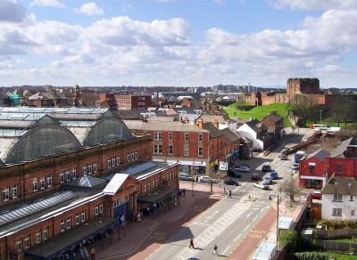
Carlisle to Settle Scenic Railway
| Destination: Carlisle | Operator: Crusader Holidays Terms |
| Departs: 03/05/2012 | Type: Short Breaks |
| Duration: 3 days | Quality: Good * * * |
| Departs Via: South East | Board: Half Board |
| Tour Code: J16753 | Transport: Coach Pickup |
Supplements
| Single Room | £35.00 per person |
Adults £199.00
Deposit Per Person Payment required in full
* Children: Not allowed
* Babies: Not allowed
Sorry, there's not enough time left to book you on this trip!
Deposit Per Person Payment required in full
* Children: Not allowed
* Babies: Not allowed
Sorry, there's not enough time left to book you on this trip!
Description
All aboard! Experience the beauty of the rolling Yorkshire Dales and Cumbrian Fells travelling on the Carlisle to Settle Railway. It really is just the ticket!HIGHLIGHTS
• Hotel for 2 nights with breakfast & dinner
• Included scenic Carlisle to Settle rail journey
• An optional guided walking tour of Carlisle
• An optional morning trip on a preserved railway
Itinerary
DAY 1 Departure: A morning departure, stopping for lunch and refreshments en route to our hotel. DAY 2 Scenic Carlisle to Settle Rail Journey with optional* guided walking tour of Carlisle: After an optional guided walking tour of Carlisle we board our train for what is described as the most scenic and beautiful 72 mile rail journey in the country. Your train passes through rural villages and market towns, by rivers, lakes and mountains with many spectacular views. The line follows one side of the narrow gorge cut by the River Eden. As the train continues the Lake District becomes visible in the far distance, with the high mountains of the Pennines. As it approaches Appleby the tower and turrets of Appleby Castle can be seen. The line descends the Stainforth gorge, and finishes in the market town of Settle.
LAST DAY Preserved railway optional* & travel home: Subject to availability of trains, there will be an opportunity for an optional* trip on a preserved railway. Following this we depart for home, arriving in the evening.
Venue Information
Crown & Mitre Hotel, CarlisleSituated close to the historic sites of Carlisle, this hotel offers a relaxed and welcoming atmosphere. Facilities include lift, bar and restaurant and all 94 en suite bedrooms have TV, tea/coffee making facilities and hairdryer. Guests are free to use the facilities including a swimming pool & Jacuzzi.
Jury’s Inn Bradford
With its central location, Jury’s Inn offers spacious and comfortable rooms which are all en suite and provide flatscreen TVs, air conditioning and tea & coffee making facilities. The hotel benefits from a gym, stylish bar, contemporary restaurant and lift to all floors. We stay for one night at each hotel and welcome drink, porterage, and tea & coffee after dinner are all included at both hotels.
Pick-Up Points

Click the compass icons to preview pickups.

↑ Return to Top - Contact Us - F.A.Q. - Coach Operators - Group Bookings - Hotels - Attractions - Sitemap - Home
© CoachBookings.com 2026 - Company no. 5808080 - Privacy Policy - GDPR Compliance - Terms & Conditions
CoachBookings.com, 17 Birley Street, Blackpool, FY1 1EG, United Kingdom. 0345 33 11 080
CoachBookings.com, 17 Birley Street, Blackpool, FY1 1EG, United Kingdom. 0345 33 11 080