
Bookings for this holiday are now closed
You are here: Home » Events, Shows, Specials » Great British Food Weekend
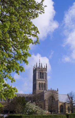
Great British Food Weekend
| Destination: Leicestershire | Operator: Crusader Holidays Terms |
| Departs: 08/06/2012 | Type: Events, Shows, Specials |
| Duration: 4 days | Quality: Good * * * |
| Departs Via: South East | Board: Half Board |
| Tour Code: J16676 | Transport: Coach Pickup |
Supplements
| Single Room | £70.00 per person |
Adults £259.00
Deposit Per Person Payment required in full
* Children: Not allowed
* Babies: Not allowed
Sorry, there's not enough time left to book you on this trip!
Deposit Per Person Payment required in full
* Children: Not allowed
* Babies: Not allowed
Sorry, there's not enough time left to book you on this trip!
Description
Indulge yourself and at the same time take the opportunity to learn how some of our national favourites are made.HIGHLIGHTS
• Hotel for 3 nights with breakfast and dinner with glass of wine on first night
• Demonstration of pork pie making
• Talk on local cheeses and tasting
• Included excursion to Belvoir Castle and gardens
• Included visit to Belvoir Brewery and beer tasting
Itinerary
DAY 1 Departure: A morning departure stopping for lunch and refreshments en route to your chosen hotel where you will be met with a welcoming tea or coffee. DAYS 2-3 At leisure with two included excursions. Melton Mowbray: Today we visit this historic market town visiting Ye Olde Pie Shoppe where there will be a demonstration of pork pie making; The Melton Cheese Board where you will hear a talk on local cheeses before tasting the produce and the Melton Carnegie Museum where you can see the history of the town, its cheeses and Stilton trades. You will also have the opportunity to sightsee and shop in this lovely market town.
Belvoir Castle and Brewery: Entrance is included to Belvoir Castle and Gardens. Built in 1509 this magnificent castle and gardens occupy a stunning hill top location overlooking the Nottinghamshire countryside. We then move on to Belvoir Brewery where you will have a guided tour and the chance to sample the local brews.
LAST DAY Travel Home: We depart for home arriving during the evening
Venue Information
Marriott Hotel LeicesterLocated close to the Leicester Fosse Shopping Park, this hotel has a lift and offers a high level of luxury with a heated indoor pool, sauna, steam room and gym facilities. All en suite bedrooms feature flat screen TV, air conditioning, hairdryer and tea/coffee making facilities.
Pick-Up Points

Click the compass icons to preview pickups.

↑ Return to Top - Contact Us - F.A.Q. - Coach Operators - Group Bookings - Hotels - Attractions - Sitemap - Home
© CoachBookings.com 2026 - Company no. 5808080 - Privacy Policy - GDPR Compliance - Terms & Conditions
CoachBookings.com, 17 Birley Street, Blackpool, FY1 1EG, United Kingdom. 0345 33 11 080
CoachBookings.com, 17 Birley Street, Blackpool, FY1 1EG, United Kingdom. 0345 33 11 080