0345 33 11 080
CoachBookings Logo
Bookings for this holiday are now closed
You are here: Home » Events, Shows, Specials » Haworth Nostalgia Weekends - 1960's

Haworth Nostalgia Weekends - 1960's

Destination: YorkshireOperator: Crusader Holidays Terms
Departs: 15/06/2012Type: Events, Shows, Specials
Duration: 4 daysQuality: Good * * *
Departs Via: South EastBoard: Half Board
Tour Code: J16520Transport: Coach Pickup
Supplements
Single Room £40.00 per person
Adults £199.00
Deposit Per Person Payment required in full
* Children: Not allowed
* Babies: Not allowed
Sorry, there's not enough time left to book you on this trip!
Description
Bring the swinging 60's to life as Haworth village transforms itself for a weekend of Mary Quant, mods, Minis and much much more!

HIGHLIGHTS
• Hotel for 3 nights with breakfast, dinner and welcome drink
• Included excursion to Haworth 1960’s weekend and Yorkshire Dales
Itinerary
DAY 1 Departure: A morning departure, stopping for lunch and refreshments en route to our weekend hotel.

DAYS 2-3 At leisure with two included excursions. Haworth 1960’s celebrations: We visit the quaint village of Haworth. Spend the day travelling back to the 1960s, with scooter parades, live music, street performers and re-enactors bringing the swinging decade to life.

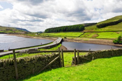
Haworth or Yorkshire Dales: For the real 1960’s buffs we have the opportunity to return to Haworth. For those wanting something different, today enjoy a day in the Yorkshire Dales.

LAST DAY Travel home: We depart for home, stopping en route for lunch, arriving home during the evening.
Venue Information
Jury’s Inn Bradford

Offering a city centre location this hotel has a restaurant, bar and Gym. The 198 en suite bedrooms feature flat screen TV's, air conditioning, and tea/coffee making facilities. There is a lift to all floors and porterage is included.
Picture: Click to ViewPicture: Click to View
Pick-Up Points
.Ashford The Prince Albert Roundabout Map
.Attleborough Outside HSBC Bank Map
.Barking Longbridge Road Bus Stop Map
.Basildon Coach Stop Outside Trafford House Map
.Beckenham Bus Stop Opposite Wimpy Map
.Beddington Broadway Bus Stop Opposit Plough Public House Map
.Bexhill Town Hall Map
.Bexleyheath Central Library Map
.Billericay Bus Stop Map
.Birchanger M11 Services Coach Park Map
.Bletchley Bus Station Map
.Blythburgh A12 White Hart Public House Map
.Brentwood Outside Holiday Inn Map
.Brighton St Peters Church Bus Stop Map
.Bromley Bromley North Railway Station Map
.Buckhurst Hill Outside Premier Inn Map
.Bury St Edmunds Bus Stop Outside Tesco Map
.Cambridge Bus Stop Outside Railway Station Map
.Canterbury Outside Canterbury East Railway Station Map
.Carshalton Bus Stop Near Post Office Map
.Chalkwell Park Bus Stop Map
.Chatham Go Outdoors Bus Stop, Adjacent To Gala Bingo Map
.Cheam Bus Stop A Map
.Chelmsford Coach Bay Map
.Cheshunt Turners Hill (B176) Map
.Clacton On Sea Crusader Business Park Map
.Clacton-on-Sea Outside Railway Station Map
.Colchester Outside Gala Bingo Map
.Crawley Bus Station, Stand E Map
.Crawley Stand E, Bus Station Map
.Crayford Opposite Town Hall Map
.Crowborough Jades Palace Restaurant Map
.Dagenham Outside Morrisons Map
.Dartford Civic Centre Bus Stops Map
.Dover Dover Passenger Terminal Map
.Dunstable Bus Stop Layby Map
.Eastbourne Outside Pier Entrance Map
.Eltham Rail Station Bus Terminus Map
.Enfield Town Southbury Road Bus Stop Map
.Ewell Bus Stop Opposite Bourne Hall Map
.Faversham Bus Stop Outside Sports Gnd Map
.Folkestone Bus Stop Outside BP Garage Map
.Frinton On Sea Bus Stop Adjacent To Railway Station Map
.Gants Hill Outside Network Q Map
.Gillingham Bus Stop Map
.Gorleston The Library Map
.Gravesend Layby Outside Sainsburys Map
.Grays The Oak Public House Map
.Great Yarmouth Vauxhall Railway Station Map
.Hadleigh Bus Stop Opposite Fire Station Map
.Harlow Bus Station, Near Taxi Rank Map
.Hastings Summerfield Sports Centre Map
.Hatfield Galleria Centre Main Entrance Bus Stop Map
.Hemel Hempstead Outside Bus Station Map
.Holland On Sea The Roaring Donkey Map
.Hornchurch North Street Queens Theatre Bus Stop Map
.Hove Bus Stop Outside Town Hall Map
.Ipswich Railway Station Map
.Kelvedon Railway Tavern Bus Stop Map
.Kessingland Post Office Map
.Kings Langley Outside GPO Sorting Office Map
.Kingston Bus Stop B4 Map
.Kirby Cross Bus Stop Opposite Railway Station Map
.Leigh On Sea Outside The Elms Public House Map
.Leighton Buzzard Bus Stop Outside Halifax Map
.Loughton Trapps Hill Bus Stop Map
.Lowestoft Bus Stop Outside Railway Station Map
.Luton Travel Lodge Map
.Maidstone Bus Stop Map
.Marks Tey Bus Stop Outside Fish & Chip Shop Map
.Mildenhall Barton Mills A11 Little Chef Travel Lodge Map
.New Eltham Bus Stop Opp Railway Station Map
.Newmarket Bus Stop Palmers Map
.Norwich Bus Layby John Lewis Map
.Pakefield Tramway Hotel Map
.Pease Pottage M23 Services Map
.Polegate Bus Stop Outside St George Church Map
.Ponders End Tescos Map
.Potters Bar Bus Stop Junction Of Southgate Road Map
.Rainham Outside Cricketers PH Map
.Rayleigh Outside Railway Station Map
.Redbridge Outside Tube Station Map
.Reigate Bus Stop Map
.Rochester Bus Lay By Near Dickens Centre Map
.Romford St Edwards Way Map
.Sevenoaks Bus Terminus, Entrance Off High Street Map
.Shoeburyness Bus Stop Inside Asda Map
.Sidcup Bus Stop Near Police Station Map
.Sittingbourne Railway Station Map
.South Benfleet New Bus Stop Map
.South Mimms M25/A1M Services Coach Park Map
.Southchurch Outside White Horse Map
.Southend Victoria Circus Bus Stop Map
.St Albans Bus Stop Outside DM Jewellers Map
.Strood Bus Stop Map
.Sutton Bus Stop L Opposite Police Station Map
.Thetford Minstergate Bus Station Map
.Thorpe Bay Railway Station Map
.Thurrock Moto Services Coach Park Map
.Tolworth Bus Stop F, Outside Marks & Map
.Tonbridge Bus Layby Map
.Tunbridge Wells Bus Stop B Near Railway Station Map
.Upminster Bus Stop A Opp. Railway Station Map
.Waltham Cross Hertford Road Bus Stop Map
.Walthamstow Bus Stop Opposite Hospital Map
.Watford Watford Railway Station Map
.Westcliff Palace Theatre Map
.Wickford Halls Corner Map
.Witham Lloyds The Chemist Map
.Woodford Green Bus Stop Opposite Castle Public House Map
.Worthing Outside Central Railway Station Map
.Wrentham A12 Village Bus Stop Map
Click the compass icons to preview pickups.
↑ Return to Top - Contact Us - F.A.Q. - Coach Operators - Group Bookings - Hotels - Attractions - Sitemap - Home