
Bookings for this holiday are now closed
You are here: Home » Festive Breaks » Christmas in Bournemouth
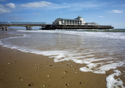
Christmas in Bournemouth
| Destination: Bournemouth | Operator: Crusader Holidays Terms |
| Departs: 23/12/2010 | Type: Festive Breaks |
| Duration: 5 days | Quality: Good * * * |
| Departs Via: South East | Board: Half Board |
| Tour Code: D7039 | Transport: Coach Pickup |
Supplements
| Single Room | £45.00 per person |
Adults £509.00
Deposit Per Person Payment required in full
* Children: Not allowed
* Babies: Not allowed
Sorry, there's not enough time left to book you on this trip!
Deposit Per Person Payment required in full
* Children: Not allowed
* Babies: Not allowed
Sorry, there's not enough time left to book you on this trip!
Description
Why not enjoy the festive season away from home with this wonderful break away from all of the hassle? A lovely hotel in a great location.Itinerary
Day 1 DepartureA morning departure, stopping for lunch and refreshments en-route to our hotel.
Days 2-4 At leisure
At leisure in Bournemouth with two included excursions and all the usual Christmas festivities.
Included Excursion
Half Day Dorset’s Jurassic Coast A half day included excursion to Dorset’s Jurassic Coast, visiting Swanage and Lulworth Cove.
Included Excursion
Half Day New Forest A half day excursion to the New Forest and Lyndhurst.
Last Day Travel home
We depart for home, arriving during the evening.
Venue Information
Trouville HotelWe stay for 4 nights at the Trouville Hotel, close to the town centre & beaches. Facilities include restaurant, bar, indoor heated swimming pool, jacuzzi & sauna. All bedrooms are en suite and have TV, telephone, hairdryer, and tea & coffee making facilities.
Pick-Up Points

Click the compass icons to preview pickups.

↑ Return to Top - Contact Us - F.A.Q. - Coach Operators - Group Bookings - Hotels - Attractions - Sitemap - Home
© CoachBookings.com 2026 - Company no. 5808080 - Privacy Policy - GDPR Compliance - Terms & Conditions
CoachBookings.com, 17 Birley Street, Blackpool, FY1 1EG, United Kingdom. 0345 33 11 080
CoachBookings.com, 17 Birley Street, Blackpool, FY1 1EG, United Kingdom. 0345 33 11 080