
Bookings for this holiday are now closed
You are here: Home » Short Breaks » A Welsh Railway Weekend
A Welsh Railway Weekend
| Destination: Caernarfonshire | Operator: Bakers Coaches Terms |
| Departs: 02/10/2010 | Type: Short Breaks |
| Duration: 2 days | Quality: Good * * * |
| Departs Via: Midlands | Board: Half Board |
| Tour Code: D10669 | Transport: Coach Pickup |
Supplements
| Single Room | £15.00 per person |
Adults £101.00
Deposit Per Person Payment required in full
* Children: Not allowed
* Babies: Not allowed
Sorry, there's not enough time left to book you on this trip!
Deposit Per Person Payment required in full
* Children: Not allowed
* Babies: Not allowed
Sorry, there's not enough time left to book you on this trip!
Description
Enjoy two of Wales’ extra special steam railways this weekend.Itinerary
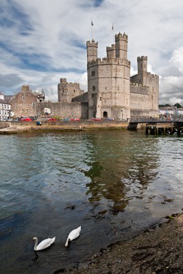
We shall drop you in Caernarfon at the home to the Welsh Highland Railway, where you will travel to Beddgelert to spent time in this super little town. Returning through the
spectacular scenery to the Celtic Royal hotel where you will spend the evening. On Sunday we shall experience a second
part of Wales’ steam heritage at the Ffestiniog narrow gauge railway, which takes you on a 13½-mile journey from the
harbour in Porthmadog to the slate-quarrying town of Blaenau Ffestiniog.
Venue Information
Celtic Royal HotelThe Celtic Royal Hotel is a stylish hotel is located in the famous town of
Caernarfon, consisting of 110 en-suite bedrooms, a fine dining restaurant, a
chic Art Deco bar, and a superb leisure club.
Pick-Up Points

Click the compass icons to preview pickups.

↑ Return to Top - Contact Us - F.A.Q. - Coach Operators - Group Bookings - Hotels - Attractions - Sitemap - Home
© CoachBookings.com 2026 - Company no. 5808080 - Privacy Policy - GDPR Compliance - Terms & Conditions
CoachBookings.com, 17 Birley Street, Blackpool, FY1 1EG, United Kingdom. 0345 33 11 080
CoachBookings.com, 17 Birley Street, Blackpool, FY1 1EG, United Kingdom. 0345 33 11 080